personal intro
Graduated in Economics and Marketing, currently graduate student
in Communication Design at PoliMi
and great supporter of design thinking.
cm.cutrupi@gmail.com
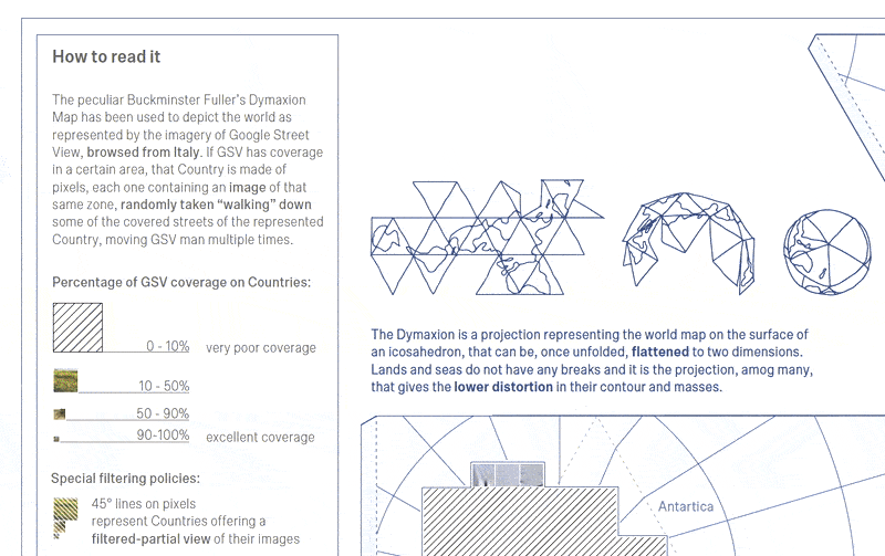
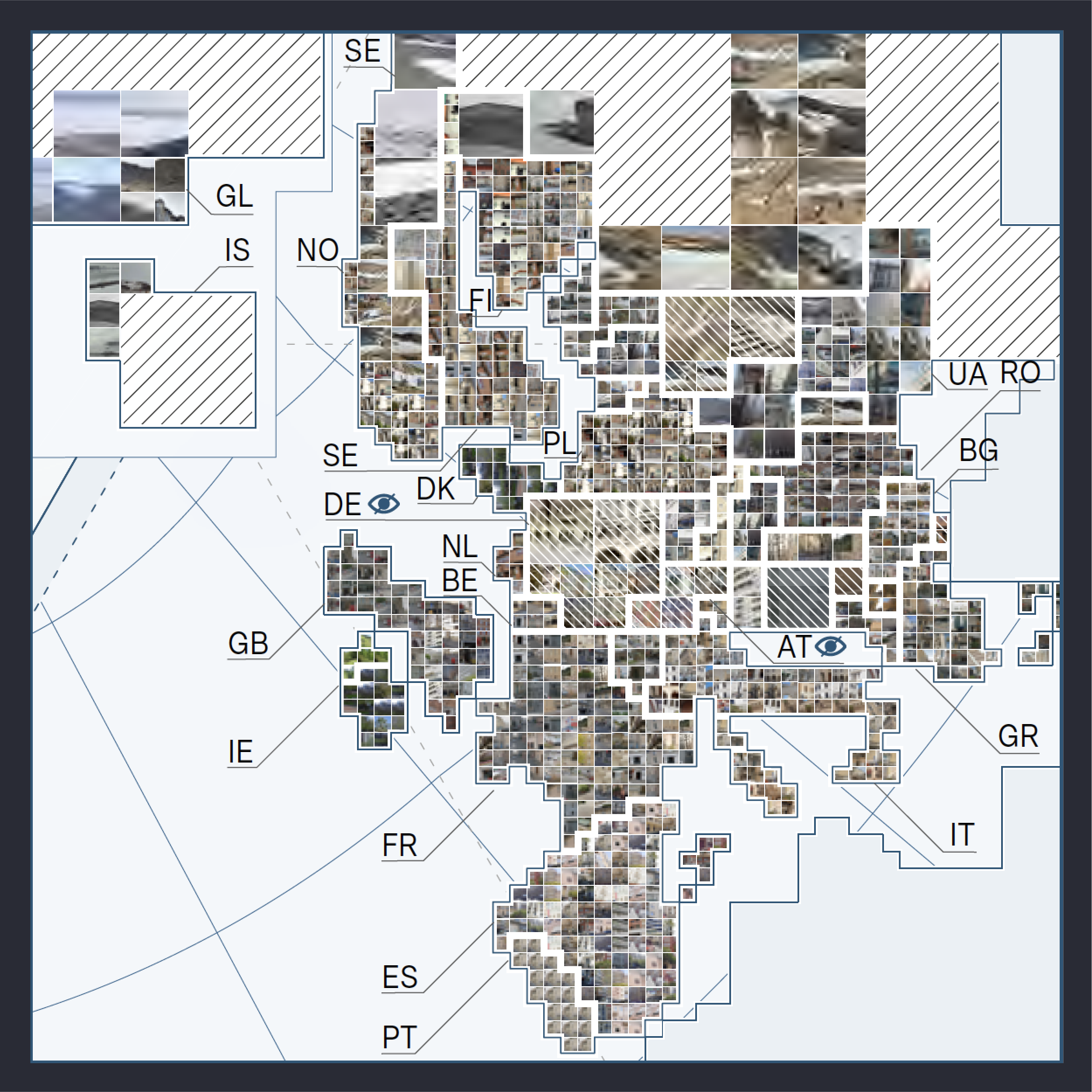
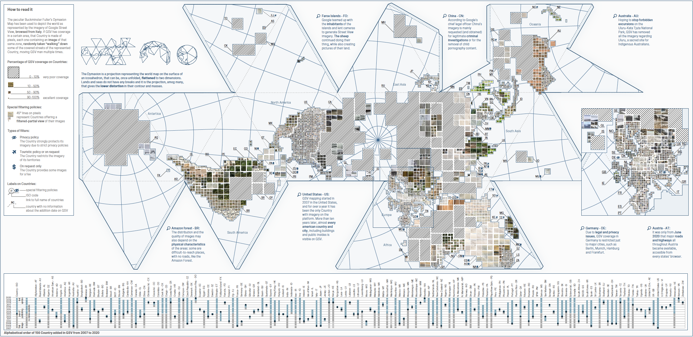
Visualization Map of the World representing the portions of lands mapped by Google Street View, from 2007 to 2020.
Data Visualization
Since it first launched in 2007 Google Street View (GSV) has managed to capture over sixteen million kilometres of Street View imagery across eighty-three countries. This visualization reports the most and lowest lands that are covered from GSV.
other designers for this project: Sara Ferrini, Beatrice Maggi, Gaia Panfoli, Isabella Possaghi, Virgilia Ramella